Category Archives: Information Solutions
Marine Heatwave
Thursday, June 22, 2023 - 12:00amMarine Heatwaves The following marine heatwave images were computed following the method in Hobday et al. (2016), slightly altered for the CCS, using both the WCOFS model output and forecast and the historical run of the West Coast ROMS. WCOFS is run by NOAA CO-OPS operationally. West Coast ROMS is run as a research model […]

CUTI and BEUTI Upwelling Indices post
Tuesday, December 13, 2022 - 12:00amThe Coastal Upwelling Transport Index (CUTI, pronounced “cutie”) and the Biological Effective Upwelling Transport Index (BEUTI, pronounced “beauty”) are two new west coat upwelling indices. The indices are derived using ocean models, satellite data, and in situ data. CUTI provides estimates of vertical transport near the coast. It was developed as a more accurate alternative […]


Morro Bay Oyster Dashboard
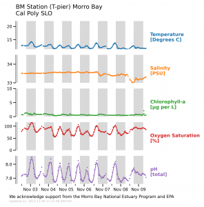
Thursday, July 28, 2022 - 12:00amOyster aquaculture along the U.S. West Coast is occurring in a changing ocean where ocean acidification (OA) and deoxygenation are altering growing conditions. To adapt to and/or mitigate the effects of OA on aquaculture production and operations, oyster growers use the information on ocean weather and water quality to manage their operations, exposure to risk […]


