Observing a Changing Ocean
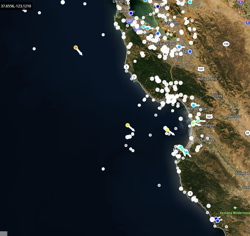
CeNCOOS collects, curates and disseminates many types of data about our ocean — everything from how acidic ocean waters are (pH) to water temperatures, currents and even whether there are toxic algae blooms in our region. CeNCOOS By combining measurements of coastal and ocean elements, or variables, we can begin to understand environmental systems and processes. Here are a few examples of how observations enable understanding of atmospheric conditions, ocean movement, water quality, and marine biology and ecosystems.
Atmospheric processes
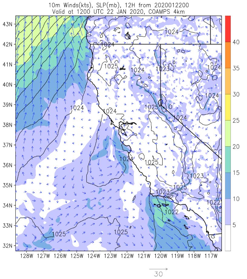
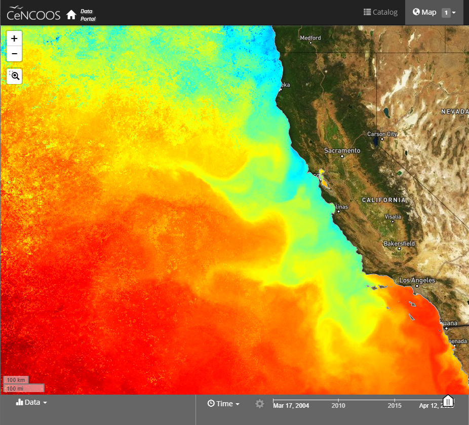
Air temperature and winds are important for understanding not just the weather on land, but also the temperature of the ocean. In California, the winds are famous driving a process called upwelling (possible link to an explainer on Upwelling). The COAMPS Model has been tailored to the Central California atmospheric processes.
– In situ measurements (https://data.cencoos.org/?ls=6999c812-20a1-fc6f-2997-244174d0eebc#map)
– COAMPS Atmospheric Model (https://www.cencoos.org/observations/models-forecasts/#COAMPS-Model)
Water Quality
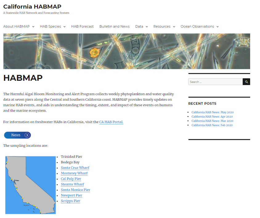
Water quality is a general way to describe the chemical and physical content of the water. This can come in the form of measuring how much salt is in the water (called salinity), the temperature, how much phytoplankton are present, the amount of nutrients and dissolved oxygen in the water, or how acidic the water is. Water quality can be affected by many naturally and human-caused influences including pollution from power plants, agriculture, and even cars and highways.
Featured Data:
Morro Bay T-Pier Data View (https://data.cencoos.org/?ls=e81f02f0-8fbe-7325-7b41-f354c8e5636f#data/1)
Ocean Movement
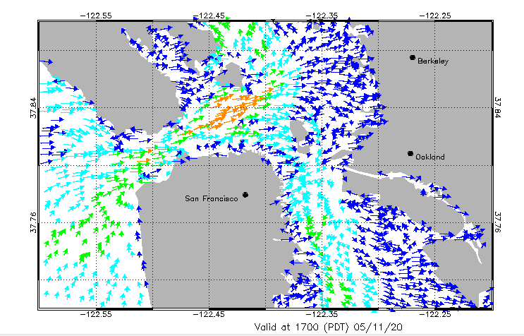
Ocean currents and waves transport energy, heat, nutrients, and other potentially harmful substances such as pollutants and HABs throughout the ocean and onto our beaches. Measurements of the physical properties of the ocean, including wind, surface currents, temperature and salinity allows oceanographers to track the movement of ocean water from individual particles to large underwater currents.
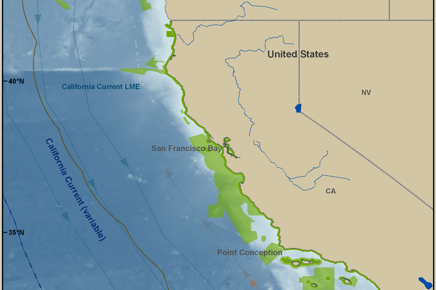
One important physical process on the California coast is upwelling (see above). When winds blow across the ocean surface push water away, deep nutrient rich water then rises up from beneath the surface to replace the water that was pushed away. Upwelling season and hotspots (Point Conception and Point Arena).
Featured Data: MUR SST Climatology (May) and COAMPS Wind Climatology (May) (https://data.cencoos.org/?ls=403b6ffa-f6c2-5003-67c8-d8caa1730ae1#map)

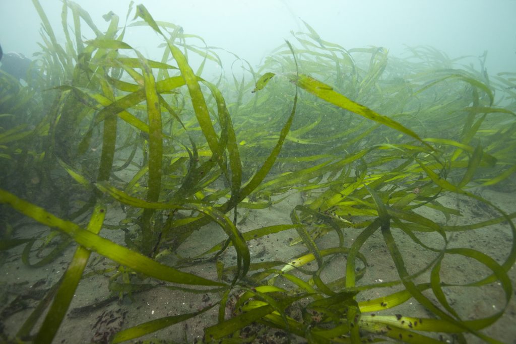
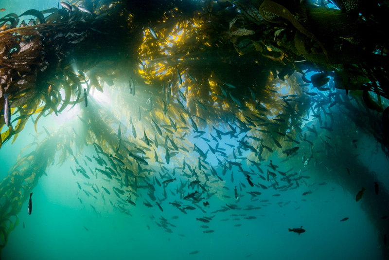
Biology & Ecosystems
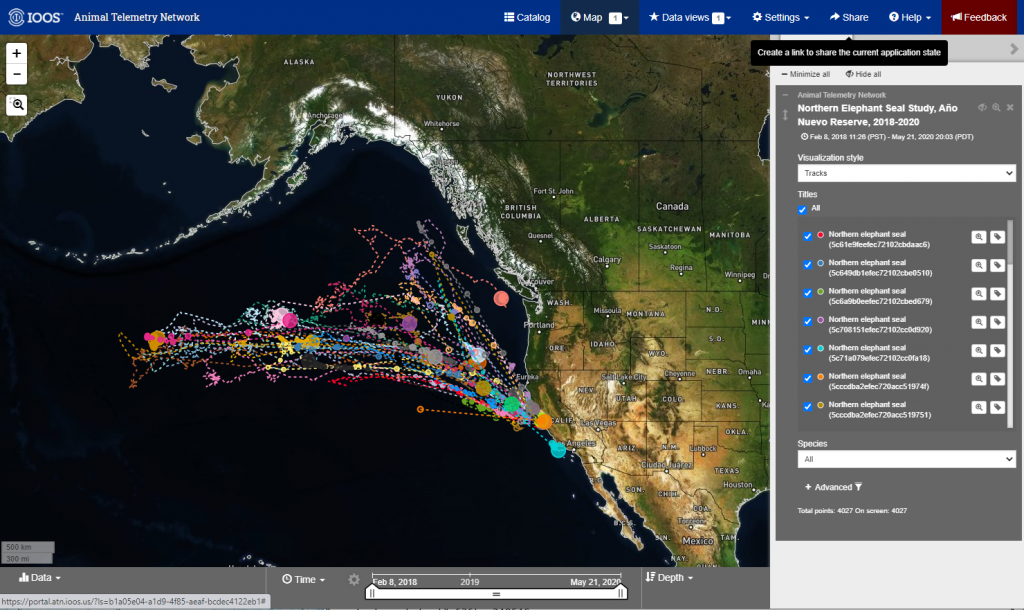
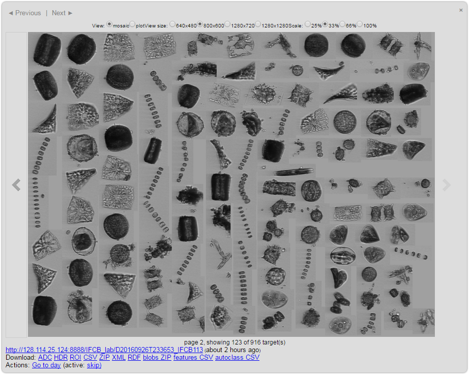
The grand challenges and questions for the California Current Large Marine Ecosystem (CCLME) are related to the characteristic oceanography (i.e. upwelling), environmental variability and their interactions with society. The CCLME is one of the major Eastern Boundary Upwelling Ecosystems (EBUE) of our ocean. These EBUE have increased biological productivity, significant harvests of living marine resources (fish, squid and shellfish) and an abundance of charismatic/protected fauna (whales, seabirds, elephant seals, sharks, etc.). The animals are composed of resident species, those that spend their full life cycles in the CCLME, and highly migratory varieties, those that spend aspects of their life cycles outside of the CCLME.
Featured Data: Krill, seabirds, groundfish…