Category Archives: Data by Location
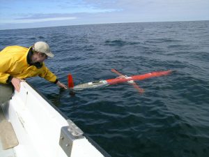
Spray2 Line 66.7
Thursday, February 05, 2026 - 12:00amCurrent Glider Position Track (blue line) and current location (red dot) A glider continuously transects CalCOFI Line 66.7 between Monterey Bay and 500 km offshore to the southwest. Gliders have been collecting observations along this track since 2007. The map on the right shows the current location of the active spray 2 glider. This particular […]
ACCESS: Marine Mammal and Seabird Surveys
Monday, October 05, 2020 - 12:00amMarine mammal and seabird observations from the Applied California Current Ecosystem Studies program are now available through the CeNCOOS Data Portal. ACCESS was formed in 2004 as a multidisciplinary collaborative between Point Blue Conservation Science, Cordell Bank National Marine Sanctuary and Greater Farallones National Marine Sanctuary. It supports marine wildlife conservation and healthy marine ecosystems […]
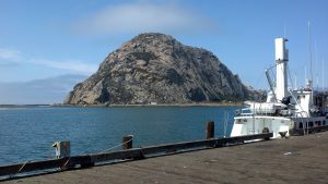
Morro Bay T-Pier Shore Station
Tuesday, June 09, 2020 - 12:00amView this station in the Data Portal.
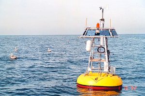
MBARI M1 Mooring
Tuesday, June 09, 2020 - 12:00amView this station in the Data Portal.